Contents
Road safety is not just a matter of personal responsibility but a shared societal challenge. With growing populations, expanding cities, and an increasing number of vehicles on the road, ensuring safe and efficient transportation has become more urgent than ever. Traffic congestion, deteriorating infrastructure, and unpredictable environmental conditions continue to contribute to accidents and delays. Traditional methods of monitoring road safety, like ground patrols, static sensors, and local surveys, can be limited in scope, time-consuming, and expensive to scale. But now, a new perspective is emerging from above.
The Role of Satellite Data in Road Safety
The use of latest satellite imagery is becoming a powerful tool in the movement toward safer roads. With the ability to capture vast, high-resolution views of the Earth’s surface, satellites offer an unparalleled advantage: they can monitor thousands of kilometers of road networks in a matter of minutes. What makes this technology especially valuable is its consistency and accessibility. Authorities can detect latest changes in satellite images and receive updates without needing to be physically present in the area, making road monitoring more responsive and cost-effective.
From a strategic standpoint, this kind of data allows urban planners and road safety officials to better understand how infrastructure evolves and where the most pressing risks lie. It’s no longer about reacting to problems after they occur. Satellite images enable a shift toward anticipation and prevention.
How Satellite Imagery Improves Road Safety
The practical applications of satellite imagery in road safety are already proving transformative. Satellite-based observation allows cities to monitor infrastructure degradation that might otherwise go unnoticed, such as cracked pavement, worn-down shoulders, or blocked drainage systems that could flood a road in heavy rain. Identifying these conditions early makes it possible to schedule targeted repairs before they become safety hazards.
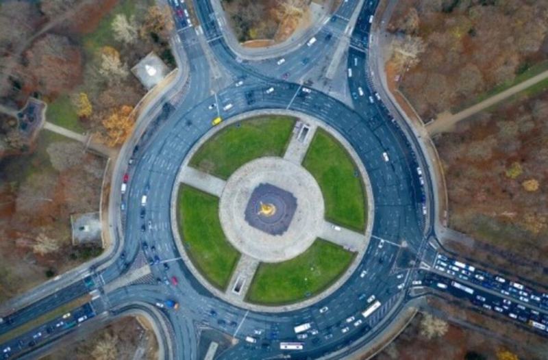
Another key benefit is traffic flow analysis. Unlike stationary traffic cameras that offer a narrow field of view, most recent satellite imagery provides a wide-angle lens to observe how traffic behaves across a whole city or region. This helps identify chronic congestion points, unsafe intersections, and areas prone to sudden stops or collisions.
In areas prone to natural disasters, satellite data becomes essential. When a landslide blocks a highway or a flood cuts off a rural road, having access to recent satellite images can help emergency services assess damage and plan safe, alternate routes. This is especially valuable in regions with limited infrastructure or in times when roads must be assessed quickly and at scale.
For cities and governments that depended on platforms like Sentinel Hub EO Browser to access this type of data, the recent shutdown has left a gap. Fortunately, services like EOSDA LandViewer are stepping in to ensure continued access to reliable Earth observation tools. The platform allows users to browse, analyze, and download satellite pictures from multiple sensors, supporting informed decisions even in fast-changing environments.
Broader Transportation Benefits
The use of satellite data in transportation extends far beyond just roads. In rail systems, for example, satellites help monitor terrain shifts or vegetation overgrowth that might interfere with tracks. In aviation, satellite weather data supports safer flight planning and runway maintenance. Even maritime logistics benefit from monitoring sea ice, vessel positions, and coastal erosion.
By integrating these insights across modes of transportation, governments and businesses are able to make smarter infrastructure investments and reduce risk across the board. What ties all these applications together is the ability to observe the Earth continuously and consistently, which is something only satellite technology can deliver on such a large scale.
What’s Next for Satellite Imagery and Road Safety?
The future of road safety will likely be defined by how well we use data. With advancements in machine learning and remote sensing, satellite imagery is becoming not only more detailed but also more actionable. Soon, we might see road safety systems that automatically flag high-risk areas using live satellite feeds, or predictive models that use satellite images to forecast road wear in advance.
Access to satellite data is also becoming more democratic. With platforms offering the latest free satellite imagery, even local municipalities and small research groups can start leveraging these tools without needing massive budgets or deep technical expertise. This democratization opens the door to smarter, safer planning not just in wealthy urban centers, but in small towns and rural regions too.
In the years ahead, we can expect satellite imagery to play a more central role in how societies manage road infrastructure. It’s no longer a matter of whether these tools are useful. The question now is how quickly they can be integrated into everyday practice.
Author:
Peter Kogut
Petro Kogut has a PhD in Physics and Mathematics and is the author of multiple scientific publications. Among other topics, he has a specific focus on a satellite imagery processing and application in his academic research. Currently, Prof. Dr. Petro Kogut also works a science advisor.


